Map of the Towns of Vischers Ferry, Bloodville, Gansevoort, Rock City, and West Milton
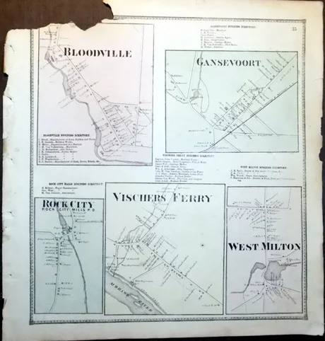
Map of the Towns of Vischers Ferry, Bloodville, Gansevoort, Rock City, and West Milton
$22.50
Beers, S.N. & D.G. Individual Map of the Towns of Vischers Ferry, Bloodville, Gansevoort, Rock City, and West Milton, from the New Topographical Atlas of Saratoga County, New York. Philadelphia: Stone & Stewart, 1866. Color map, 14” x 13.25” Lightly worn, and missing a piece of the upper left corner, affecting a little information on the map of Bloodville. Otherwise, generally clean and very good, and quite useful for research. Includes business directories for each town.